Bureau Veritas SMART EnE3-Em-W certified, 2026 European Space Agency Research contract USPTO Patent-pending Trusted by major Greek-owned fleets

The routing intelligence layer for commercial fleets

Patterns learned from millions of nautical miles, bound by physics, regulation and vessel limits. Every recommendation explained mile by mile.

Case studies

Verified voyage outcomes

Real routes, real telemetry. Every result is the optimized track measured against that vessel’s own historical AIS replay, documented and independently verifiable.

9.3% average fuel saved
7 verified voyages
255MT fuel cut
32,496nm documented

Routing that follows your objectives

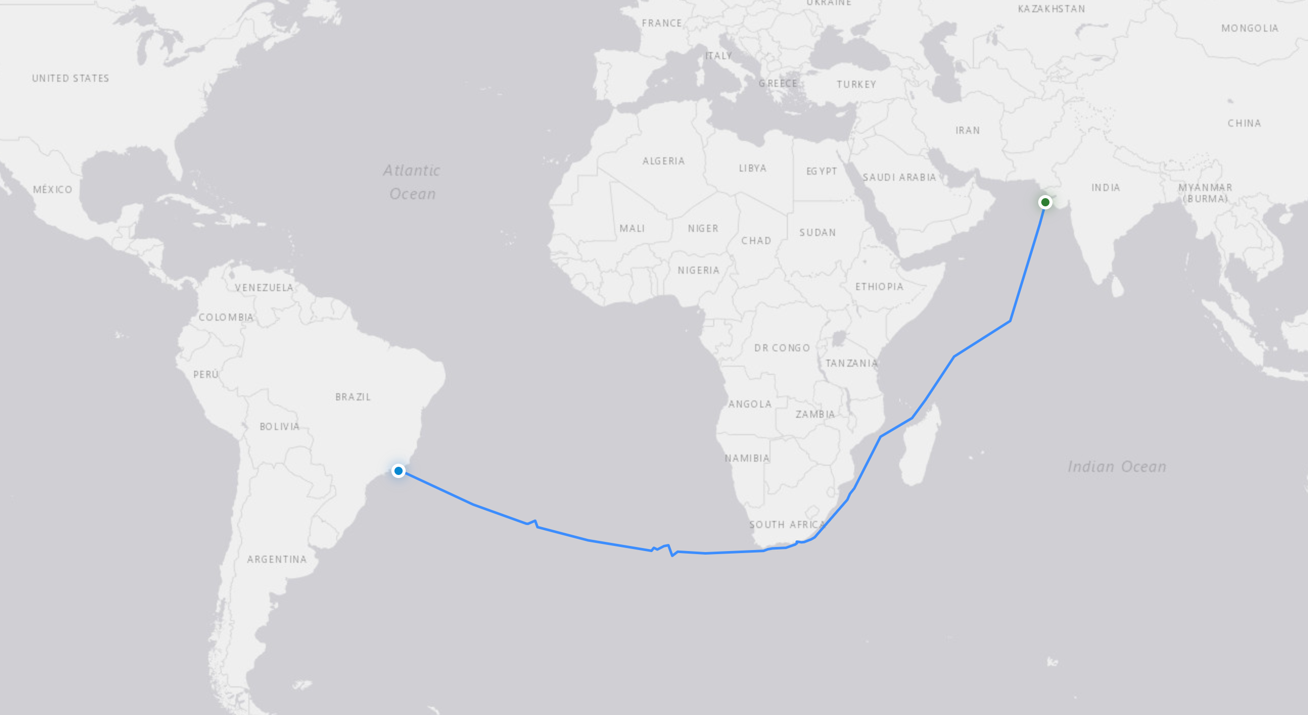
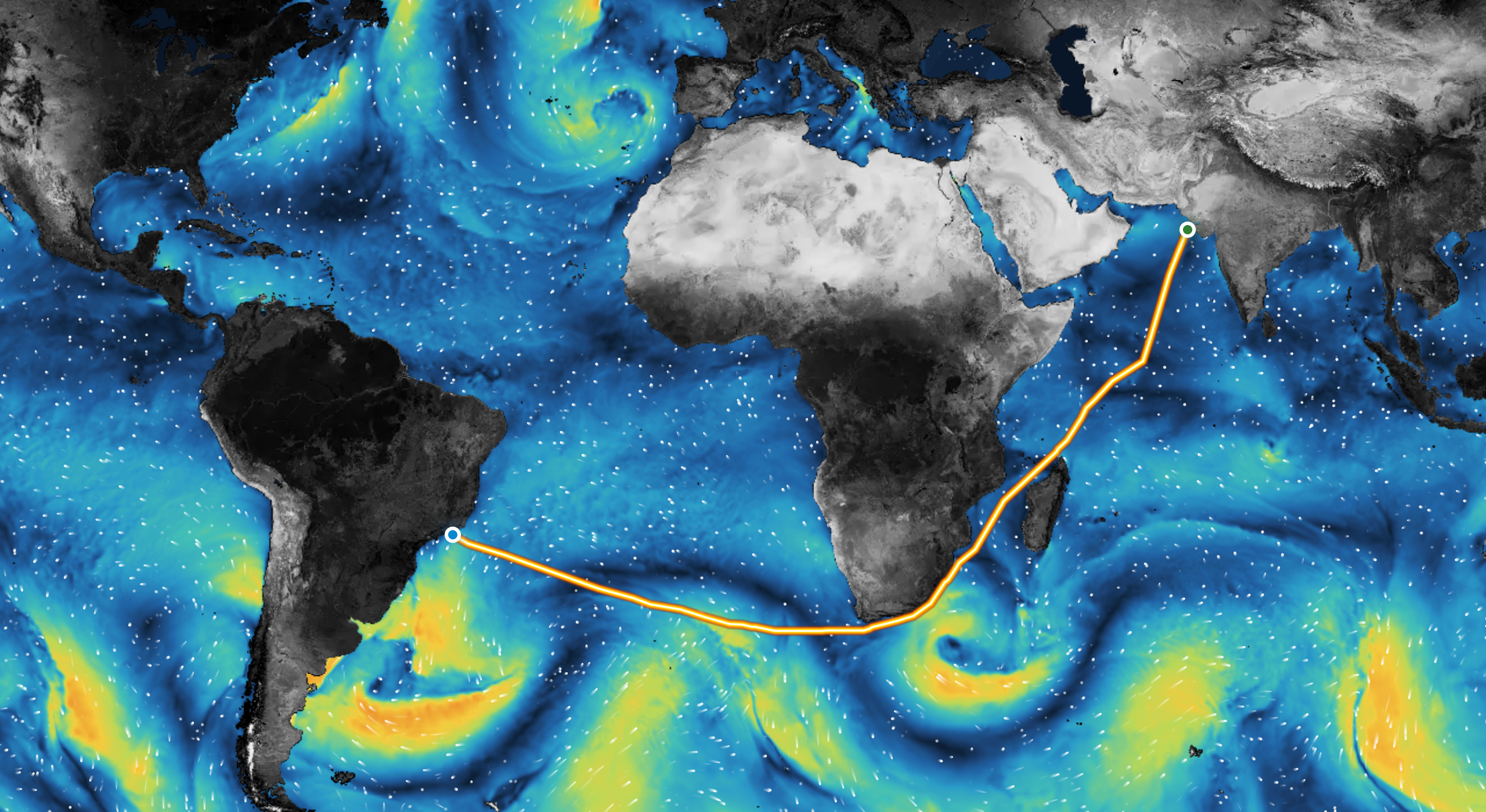
Multiple optimization modes and side-by-side comparison let you route each voyage your way. This tanker voyage from Sikka to Niterói was optimized for fuel.

The vessel's historical AIS track from Sikka to Niterói, round the Cape of Good Hope.
Historical AIS track. What the vessel actually sailed.
VesselFront's optimized track from Sikka to Niterói over the forecast wave-height field.
VesselFront track. Same voyage, over forecast wave height.
Fuel
−13.31% 579.38 vs 668.31 MT
Distance
−2.53% 200 nm shorter
Duration
−2.47% 11h 18m faster
Time in Sea State 6+
3.6% down from 6.4%
Read the Sikka to Niterói case study

Built to be trusted

VesselFront’s weather routing and voyage planning platform pairs purpose-built neurosymbolic AI with rigorous maritime engineering. It is trained on proprietary live-voyage data across fleets, vessel types and trade lanes, and refined with the operators who run them.

Connected

Live fleet visibility through AIS, noon reports and onboard telemetry, in one operational view.

Explainable

Executive summaries, emissions reports and route events you can query in plain language, with notifications and calendar integration.

Accurate

Maritime knowledge and neural networks combined for fast, accurate route options. Follow global best practice or impose your own constraints.

Certified

SMART EnE3-Em-W certified by Bureau Veritas, 2026. Charter-party compliance with a segment-by-segment Route Analyzer.

Research

27th IEEE MDM 2026 · 29 June – 2 July, Athens

VFWR: Charting the Optimal Voyage

“VFWR is validated against a dataset of 100 historical voyages using hindcast weather data, while calculating optimized routes in a median of 23 seconds and consistently producing shorter distances and durations than real-world trips across all tested voyages.”

An optimization framework for ship weather routing based on the A* path-finding algorithm, with a weather-aware heuristic incorporating real-time forecast, wave height threshold, maximum latitude constraint, no-go areas, and minimization of the duration of time within emission control areas (ECA).

100
historical voyages in the validation set, replayed on hindcast weather
22M+
grid nodes, variable resolution, denser near coasts
1-6 h
shorter trip duration across all tested voyages vs historical AIS
21.4M
real voyage records, with closed-loop feedback from operating fleets

The route you chart is the most valuable line in the world.

Plan. Optimize. Download. One vessel at a time.

Closed beta with rolling admissions.